


Abstract: The Lake Tahoe basin is well known for its stunning natural setting and world-class skiing, but the region is highly regulated due to the sensitive ecology of the lake and its tributary watersheds. Recently, a master plan for Heavenly Ski Resort in Lake Tahoe was approved and it is a model for ski area planning. As a part of the planning process, partnerships were created between Heavenly Ski Resort, the local community and those responsible for regulating it. In the plan, expansion of skiing facilities is linked to progress made on watershed restoration and other environmental improvement projects. Creative analytical techniques were utilized to accurately assess environmental impacts and develop mitigation programs. The master plan was made possible by individuals setting aside past differences and working together as partners to improve skiing and resolve environmental issues.
A succinct abstract condenses seven years of hard work into one paragraph, belying countless meetings, problems, revisions, solutions and re-revisions, with the end result of a new master plan for Heavenly Ski Resort and a new spirit of community in a traditionally contentious region.
The Forest Service Record of Decision approving the final plan breezed through without one appeal on the local, regional or federal level—an occurrence unheard-of in this highly regulated region. A partnership among unlikely bedfellows—Heavenly, the local community and those responsible for regulating it—had created solutions acceptable to all parties with an approach dubbed “the project is the fix.” This approach links ski area expansion to simultaneous progress on watershed restoration and other environmental improvements.
Heavenly’s original master plan was developed in 1966, when the ski area was still young and the technology of skiing was even younger. It had served the needs of the ski area and the Forest Service well and was still being used as a guideline into the mid-1980s. In 1986, however, the Tahoe Regional Planning Agency (TRPA) implemented a new Regional Plan for all public and private lands within the 500-square-mile watershed of the Lake Tahoe Basin. This new plan offered incentives—the ability to develop additional capacity—for ski areas to develop and implement master plans. With changes in both technology and skier preferences, it became increasingly clear that the 1966 plan needed a revision.
At the same time as the Heavenly master plan was being prepared, plans were being readied for the redevelopment of several commercial/tourist blocks of downtown South Lake Tahoe adjacent to the Stateline casino core. Heavenly’s management saw the opportunity to use this master plan to make a physical connection between the town and the ski hill—a connection that had always been missing from the Tahoe experience. At many other North American ski towns—Whistler/Blackcomb, Aspen, Vail or Telluride, for example—visitors can walk downtown from a hotel and get right on a ski lift. The opportunity to finally connect with the commercial heart of South Lake Tahoe, as well as to coordinate plans for large-scale improvements with the community, was too good to pass up.
Learning to Work Together
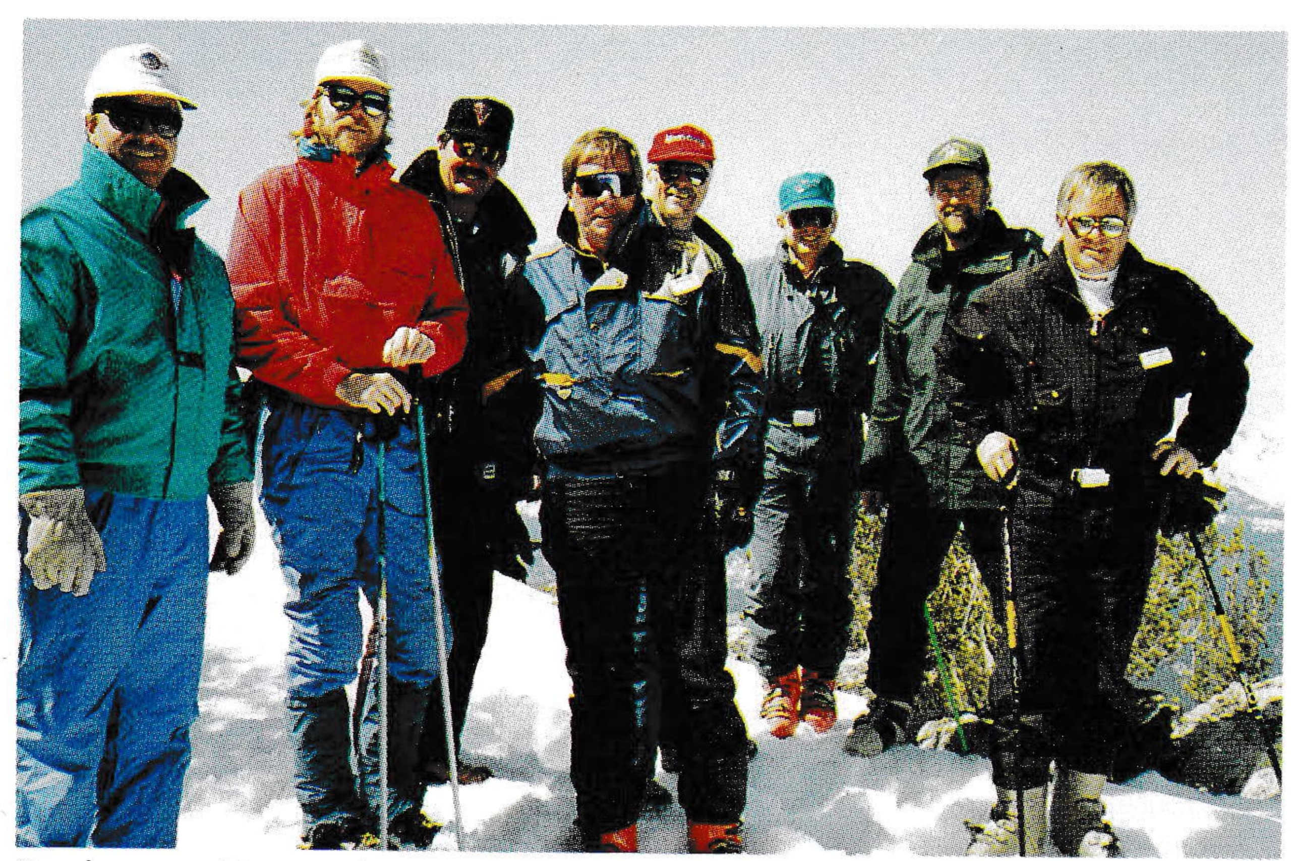
By virtue of Heavenly’s location in two states, three counties and one incorporated city with public and private land, an interagency steering committee was formed to guide the planning process. Represented on the committee: the Forest Service, TRPA, El Dorado County, Douglas County, the city of South Lake Tahoe and Heavenly Ski Resort. With this many partners involved, a written memorandum of understanding was executed so everyone involved knew what each other’s roles would be. Chaired by Forest Service representatives, the committee provided a forum for traditional adversaries to come together as partners for the good of the community and for the good of skiing.
Early in the process, heated discussions—some would call them arguments—occurred over long-held positions and beliefs. As time went on, the group began to work together more closely to build consensus and solve problems rather than continue posturing.
The steering committee appeared to turn the corner in terms of working together on a field trip one busy Saturday during the ski season. Following the old adage, “You can’t do environmental planning if you don’t know what the environment looks like,” members met for an early-morning breakfast at a local hotel, then boarded a Heavenly shuttle bus—skis in hand—to experience firsthand the average visitor’s day at Heavenly.
The morning was spent on skis looking at existing problems and opportunities around the mountain. During the afternoon, the group looked at the proposed alignments for new lifts and runs and toured facilities on the upper mountain. At the end of the day, everyone gathered in the Boulder Lodge bar for après-ski.
As much as committee members learned about the way the mountain operated on a busy day, they learned more about each other and about working together than they would have by spending the same time in a typical meeting.
The Joint Planning Process
There were three separate environmental review processes required by three separate lead agencies: National Environmental Protection Agency (NEPA), California Environmental Quality Act (CEQA) and TRPA. In order to finish the project in an efficient and cost-effective way during the committee members’ lifetimes, the firm of Harland Bartholomew Associates was retained to prepare a joint environmental document satisfying all three agencies.
The joint planning process also gave members of the local community an opportunity to understand Heavenly’s intentions and participate in the process. Public scoping meetings were held early on to present the basic concepts of the project to the community and to gather input and comments on the environmental analysis. In the end, a total of approximately 30 public meetings and open houses were held around the lake—each lead environmental agency had its own public involvement process. In addition, the steering committee prepared regular newsletters that were distributed to a mailing list of over one hundred people.
Rather than duplicate the hearings of the other lead agencies, the Forest Service held an open house and invited the public to walk through display exhibits and meet one-on-one with steering committee representatives. As each phase of the plan and environmental document was completed, formal public hearings were held before planning commissions and governing bodies.
Creative Analysis Methods
TRPA had adopted specific environmental threshold carrying capacities in 1982 as a foundation for the 1986 regional plan. The thresholds are environmental standards necessary to maintain a significant scenic, recreational, educational, scientific or natural value of the region. In addressing the environmental issues associated with expansion (soil erosion, water quality protection, snowmaking noise, visual quality impacts and wildlife resource conservation), the steering committee discovered that several issues had no mutually agreeable analytical approach—a problem stemming partially from trying to use, for the first time, TRPA’s environmental thresholds as they related to a ski area.
Out of necessity, several innovative analytical techniques were developed specifically for Heavenly’s master plan, ensuring an accurate assessment of impacts and the development of realistic mitigation measures. New techniques ran the gamut, ranging from enzyme treatment testing for erosion control to a new method of calculating ski area capacity in terms of Persons at One Time (PAOT).
In a creative use of existing methodology, staff members of the Forest Service-Lake Tahoe Basin Management Unit’s Watershed Division adapted the Cumulative Watershed Effects (CWE) methodology from Forest Service Region Five for Heavenly. The CWE analysis—originally developed for timber sales or multiple management activities within a given watershed—detailed the level of environmental risk in each watershed, guiding management decisions about where and how to develop additional facilities and in which watershed restoration efforts should be prioritized. TRPA subsequently included this model as a required element in the Ski Area Master Plan Guidelines, setting the standard for all Tahoe Basin ski area master plans.
It was agreed that the CWE would be updated annually in advance of development approvals where additional disturbance is proposed, and master plan development projects that create additional land disturbance can only be approved if the restoration projects located in the same watershed are on schedule.
Successful Mitigation
One of the watershed restoration projects which was already on the ground was the one-and-a-half acre Galaxy Flat wetland, for which Heavenly had won a Silver Eagle Environmental Excellence Award in 1995. Starting with muck soils from nearby East Peak Lake, the wetland had become more stable and diverse each year since its creation—one of the first wetlands successfully recreated at an elevation of 8,500 feet.
Erosion was another significant problem, blamed for a significant portion of progressive loss of clarity in Lake Tahoe. At Heavenly, ski run construction practices of the 1960s and 70s had caused significant erosion: several runs were completely graded and the surfaces smoothed to remove potential obstacles to skiers and allow adequate snow cover with minimal snowmaking. In many places, the highly fragile soils above 8,000 feet resembled a beach sand you might find along Tahoe’s shoreline. Despite several years of implementing summer erosion control, aggressive remedial action was needed to comply with state and regional water quality standards.
Summer irrigation proved to be a key strategy in the intensive revegetation effort aimed at reducing erosion of the granitic soils covering much of the mountain. Heavenly’s snowmaking investment in the late 1980s and early 1990s—covering over 230 acres of trails and runs—not only served the area well during several years of below-average snowfall, but also allowed irrigation of newly-planted vegetation during the summer.
Though the aggressive snowmaking expansion aided revegetation efforts, the side effect of additional noise was negatively impacting neighboring residences around the three base areas. Using computer-assisted modelling, noise contour maps were created taking into account local topography, wind speed, wind direction, the type of snowmaking equipment being used and how it was arrayed on the slope.
The analysis led to the development of measures to mitigate existing and future noise impacts on surrounding noise-sensitive land uses. Mitigation techniques included the use of fan guns rather than air/water guns and setbacks from adjacent land uses. A schedule was developed to reduce existing noise levels to TRPA’s adopted noise standards.
High-resolution computer simulation was also used to find the optimal alignment for the gondola proposed to link Heavenly with the downtown commercial core of South Lake Tahoe. To make the connection, the gondola would have to ascend a nearly undisturbed, highly visible forested hillside, cresting over a ridge and continuing on to Von Schmidt’s Flat. Though the view from the gondola would be spectacular, TRPA and the Forest Service were concerned about potential visual quality impacts of the gondola from several key viewpoints.

Detailed investigation of the visual absorption capability of various alignments led to the conclusion that, by using very careful design and siting techniques, the gondola could be built without significantly detracting from the mountain’s existing visual quality. A “low-profile” route was selected to keep the gondola and support towers at or below the height of the existing tree canopy, travelling through naturally-occurring open spaces between the trees on the ridge. Below the ridge, selective clearing of trees would be held to a minimum, designated trees would only be “topped” rather than completely removed and shrubs would be left beneath the gondola cabins. Support towers and the gondola cabins would be painted a dark color with a non-reflective matte finish and the cabins would forgo internal lights that could draw attention during after-dark operations.
Both high-tech and low-tech methods were used to study summer and winter fur-bearers inhabiting the area, along with their frequency patterns and locations. On the low-tech end, a series of detection stations—wooden boxes, open on one side, with a piece of chicken inside them to attract the animal—were placed at suitable habitats identified around the mountain. A sooted track plate was placed outside the box and inside was a piece of clean contact paper. The animal would walk across the sooted plate on the way in to investigate the chicken, leaving its tracks on the sticky contact paper inside.
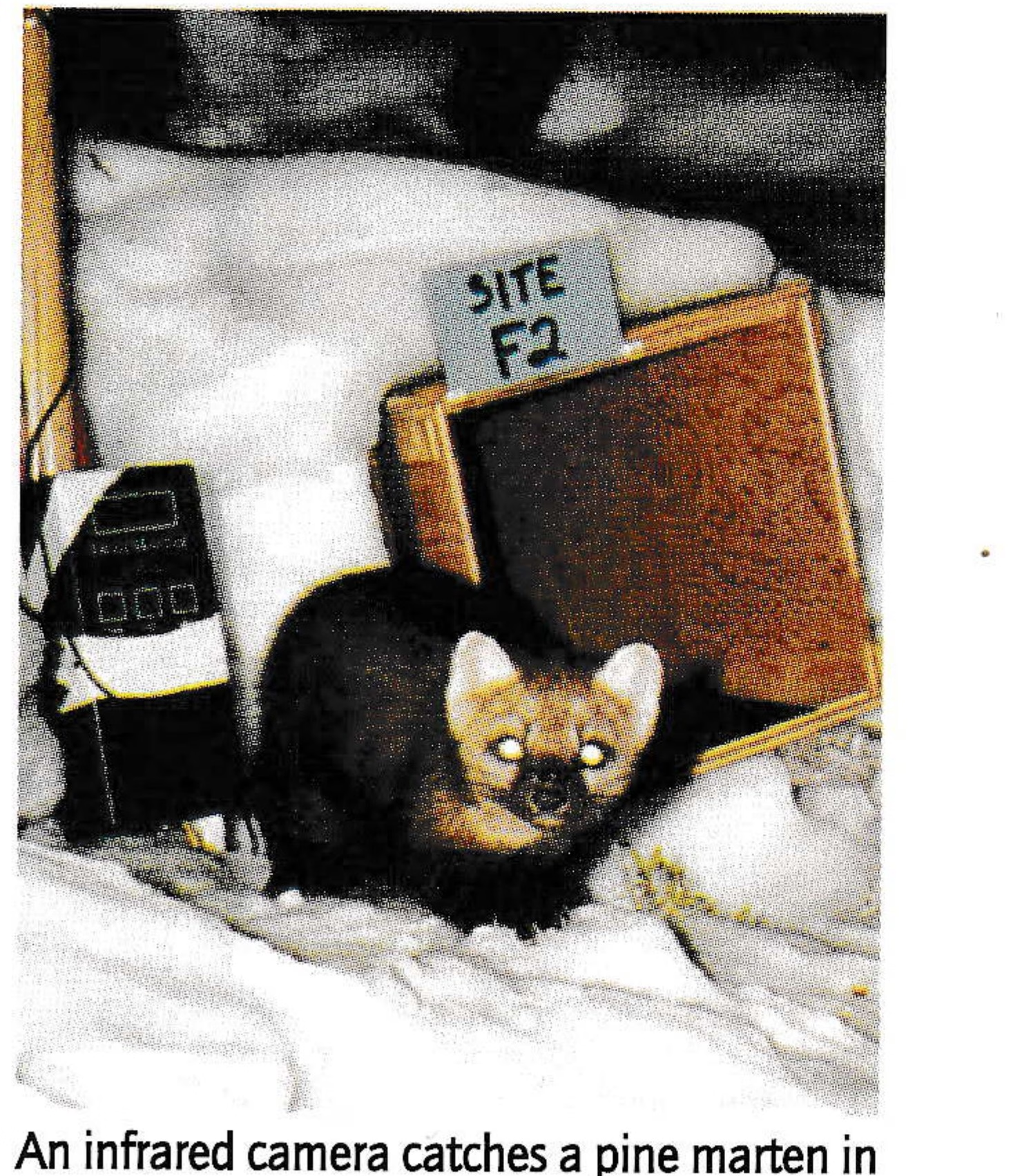
The high-tech component of the study was an infrared-triggered camera at selected stations that was aimed at the box from a vantage point in a nearby tree, so that anything coming to eat would be caught on film. To the surprise of many, the winter population of pine martens—the most prevalent species found—appear quite active at Heavenly and were actually detected more often in winter than during a similar summer investigation. But then again, the offer of free chicken wings will usually draw a crowd at most happy hours!
Lessons to Be Learned
Throughout the U.S., many ski areas make incremental changes based on what happened during the previous ski season or based on what changes their competitors are making, often leaving customers and regulatory agencies in the dark in terms of what’s coming next. The process of master planning by all the stakeholders allows piecemeal plans and projects to be avoided. Ski area managers, regulatory agencies and, perhaps most importantly, the skiing public can all see and participate in the long-term vision for the ski area. Looking back at the entire process, Heavenly President Dennis Harmon points out that we were also fortunate enough at Heavenly to have the complete commitment of our owners, Kamori International, in addition to support from the local community.
Through a public planning process, other community improvements can be planned and implemented in concert with ski resort expansion and upgrading. Coordinating the planning between primary and secondary economic bases and the transportation system that ultimately connects them can lead to a more complete design solution that can be done at a lower up-front cost than doing—and paying for—them separately. For example, Heavenly and the region’s public and private transit providers have devised a Coordinated Transit System (CTS) to mitigate additional shuttle trips associated with ski area expansion. The CTS will provide state-of-the-art, high quality, demand-responsive transit service coordinating all transit vehicles under one operating system.
Linking the timing of expansion with progress in environmental improvements—”the project is the fix”—provides a greater level of comfort to conservation-oriented interest groups. At Heavenly, additional facilities that cause watershed disturbance (e.g., new runs, roads or buildings) are linked to remedial watershed restoration efforts being on schedule. Similarly, as the on-mountain capacity expands, the off-mountain transportation system will be expanded or enhanced at the same time.
By using the master plan, regulatory agencies are able to streamline the review process of individual projects—currently a popular trend in processing permits at all levels of government. The benefit will be visible down the line as individual projects are proposed that are in the master plan and have already been evaluated to some degree in the master plan’s environmental document, similar to the practice of “tiering off” of a master environmental document.
Implementation of the first phase of the master plan began at Heavenly this summer. By next ski season, the fruits of those who labored for the good of skiing and for the good of the Tahoe Basin will become reality.
Master Plan Improvements
The master plan—estimated at $110 million over 20 years—will be developed in three phases. The cornerstone of the plan, kicking off the first phase, is a new 3,000 pph gondola that will travel from the heart of South Lake Tahoe’s commercial core up to Von Schmidt’s Flat. The gondola base station will be surrounded by a mixed-use, pedestrian-oriented district within walking distance of Stateline casino/hotels, shopping, restaurants, entertainment and a new transit center. At Von Schmidt’s Flat, a new lodge will contain a complete range of skier services, new lifts and runs will be added to access both sides of the mountain and several existing lifts will be upgraded.
In the second phase, new lift and runs will be constructed in Alderman’s Canyon and the resort’s upper mountain lodges will be remodeled. The master plan looked at a comprehensive upgrading of most of its lodges and on-mountain facilities, adding a substantial number of indoor food service seats to balance the existing amount of outdoor seating and commissioning a separate design study to improve the quality of Heavenly’s built environment.
A major target for improvement was the existing California Base Lodge. In the final phase, the existing lodge and surrounding area will be redeveloped using a mountain village concept, which will derive its architectural character and imagery from the nearby historic Pope and Valhalla estates found along the South Lake Tahoe shoreline, in decades past the summer playgrounds of moneyed residents. Design details that will serve as a source of inspiration for the new village include heavy timbers, peeled logs, stone foundations, wood siding and wood-shake roofs.
The village focal point will be a new ticket sales building that will serve as a visual focus as well as a meeting point and public congregation area. Three additional lifts will be upgraded, the new Wells Fargo lift will be added and more runs will be developed.
The addition of summer activities will improve the resort’s overall utilization and introduce summer visitors to the pristine quality of the High Sierra. The lodge at Von Schmidt’s Flat will become a hub for such activities as hiking, interpretive opportunities, dining and a summer concert series. Fishing and horseback riding at the East Peak Lodge on the Nevada side will complement the menu of summer activities.
EIR/EIS/EIS
(From the summary of the Environmental Impact Report/Statement)
“During the preparation of the Heavenly Ski Resort Master Plan EIR/EIS/EIS, five years of publicly-held Steering Committee meetings were held. These meetings allowed the introduction of, and consideration of, any issue felt relevant to the planning of a ski resort in the Lake Tahoe Basin. The vast amount of public/agency input is evident by the complexity of the analysis, which includes almost every environmental topic between “A” (air quality and archaeological resources) and “Z” (Zonotrichia leucophrys or white-crowned sparrow). Ok, “Z” may be pushing it—possibly just every topic between “A” and “W” (Wildlife).”
—Rob Bruecke, Harland Bartholomew & Associates, Inc.
Good to the Last Man
During the seven-year process of hashing and re-hashing issue after issue, the Heavenly master plan steering committee saw its own fair share of changes. TRPA went through three executive officers and Heavenly was sold twice. The Forest Service spot on the committee turned over three times while El Dorado County, Douglas County and the city of South Lake Tahoe all went through two delegates each. Stan Hansen of Heavenly and Andrew Strain of TRPA stuck it out through the whole process, however, and they proudly claim the dubious distinction of being the only two individuals who have read through the entire 18-inch-high stack—22 pounds—of documentation gathered in support of the master plan. —H.S.