

During the past several years, the Forest Service has been asked how cutting ski trails through forest land might affect streams. The question has become more frequent and important with the establishment of laws that require preparation and approval of environmental impact statements as part of the planning process for the new ski areas.
Unfortunately, there are no direct studies of the impact of ski trails on streamflow quantity and quality. On the other hand, there have been extensive studies of streamflow from forests and of how streamflow is affected by various types of forest cutting. These studies can be used to draw inferences about the potential impacts of ski trail construction and maintenance on streamflow.
How Streamflow Effects Are Determined
The effects of forest cutting on streamflow are most often studied by using the paired-watershed technique. Streamflow is measured and compared from two forested watersheds for a calibration period of several years. Then a forest cutting of desired intensity is performed on one of the watersheds. The calibration relationships are used to determine how streamflow has been changed by the cutting operation.
This is illustrated by a paired-watershed study in progress at the Hubbard Brook Experimental Forest in the White Mountains of New Hampshire. The watersheds at Hubbard Brook are typical of terrain occupied by many New England ski areas. Land slopes are steep. The major tree species are northern hardwoods interspersed with patches of spruce and fir. Soils are coarse textured and shallow, and have a limited capacity to store water.
Based on calibration data, precipitation at Hubbard Brook averages 48 inches per year. Undisturbed forests return about 20 inches per year directly to the atmosphere by evaporation and transpiration (called evapotranspiration or ET); the remaining 28 inches of water percolates through the forest soil and becomes streamflow. Precipitation is evenly distributed by months, but streamflow is not. Between 35 and 40 per cent of annual flow occurs in April, due largely to melting of the winter snow pack. In contrast, less than five per cent of annual flow comes in the growing season, June through September, because of high ET losses.
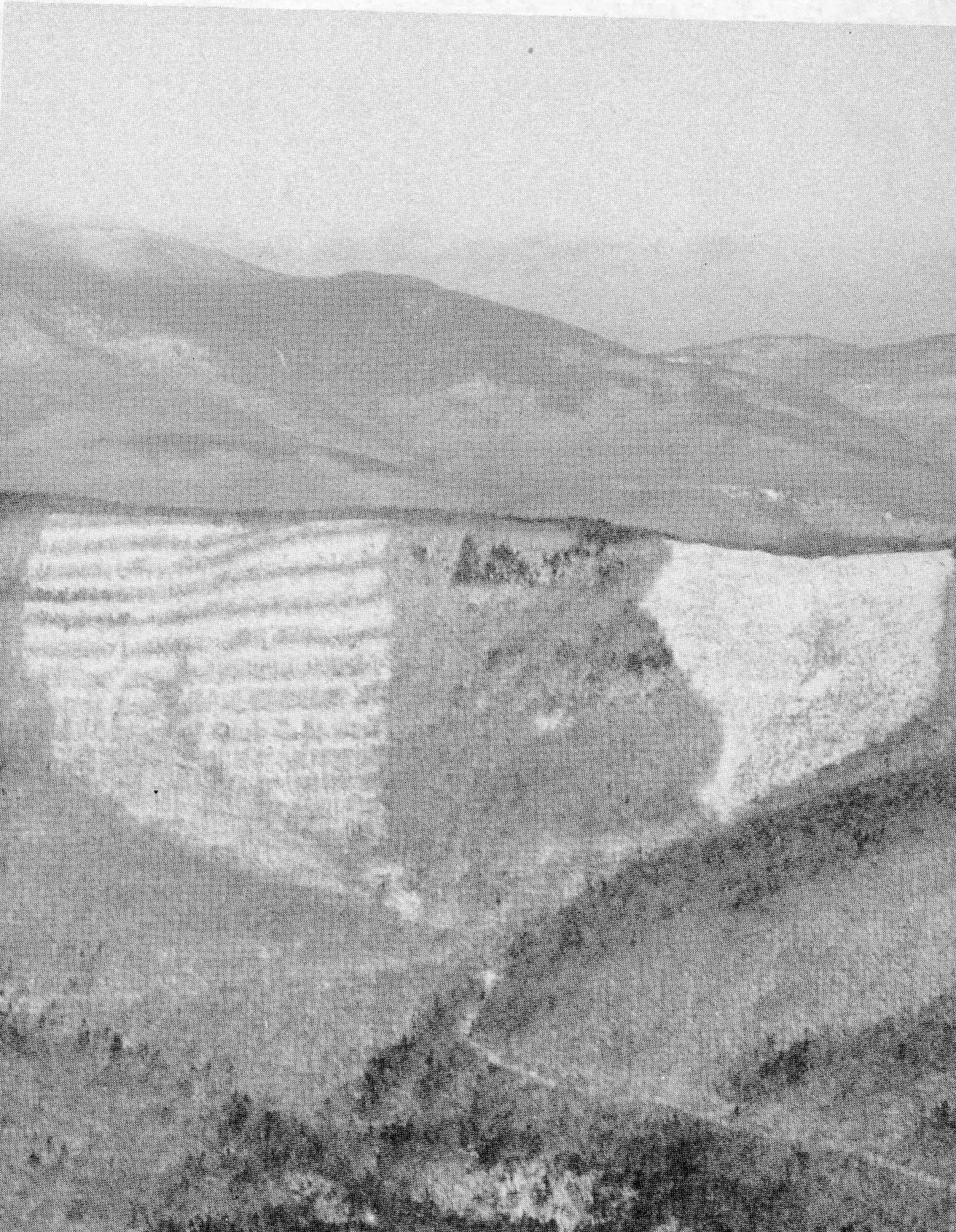
In one of the Hubbard Brook experiments, timber was harvested on 80-foot-wide strips alternating with 160-foot-wide uncut strips (fig. 1). Although cut strips run parallel to the contour, the intensity and method of cutting and strip width are otherwise similar to what might be done when forests are converted to ski trails.
In the cut strips, ET was somewhat reduced, so soils remained wetter, and more water was available for streamflow. After one-third of the watershed was cut over, annual streamflow increased 0.9 inch the first year and 1.8 inches the second year, an average increase of 3.3 million gallons per year from the 90-acre drainage.
The timing of streamflow changes showed a consistent pattern. Almost all the streamflow increase occurred during the growing-season months of June through September, the period of maximum evapotranspiration. Increases tapered off during the autumn as transpiration ceased and rainfall recharged soil moisture to similar levels on both cut and undisturbed watersheds.
Streamflow changes were small through the winter months until the start of snowmelt in March or April, when the effect of forest cutting was to advance snowmelt runoff. These advances resulted largely from more rapid snowmelt, attributable to removal of shade provided by tree trunks and canopies. Snowmelt runoff occurred four to eight days earlier after strip-cutting.
Studies of snow accumulation and melt on the strip-cut watershed have shown that about the same amount of snow reaches the ground under the canopy as in the cut strips. This finding is reinforced by streamflow measurements, which show that the strip-cutting affected only timing during the snowmelt period; total volume of snowmelt streamflow was unchanged. In conifer forests, more snow is intercepted by tree canopies and evaporated into the atmosphere than in hardwood forests. Thus, when strips are cut in conifer forests, interception of snow is reduced and snow accumulation and snowmelt runoff are increased.
Most of the growing-season increase in streamflow at Hubbard Brook occurred as augmentation of low flows. However, flows during heavy rains were also increased under certain circumstances. On the strip-cut watershed, summer stormflows were increased by an average of less than five per cent. As mentioned, soils on the cut areas remain wetter, so there is less opportunity for storing precipitation. When heavy rains occur, these soils begin to contribute water to streams more quickly than soils when transpiration has created greater opportunity for moisture storage. The difference in stormflow between cut and uncut areas will depend on how much more storage has been created on the uncut areas. In the New England mountains, where we have frequent rainfall, there is usually not much chance for large differences in storage to develop between cut and uncut forests.
As part of our watershed experiments, we have also been studying changes in water quality caused by logging operations. Major concerns include sedimentation, temperature, and chemical ion concentrations. Sedimentation usually occurs as a result of disturbances to the soil. We were successful in keeping sedimentation at low levels on the strip-cut watershed by carefully following recommended precautions for locating, constructing, and using skid trails to transport cut trees. Before the strips were cut, the maximum recorded storm turbidity was 23 units, and in most cases there was no measurable turbidity (the drinking water standard is less than 10 units). During the first two years after cutting, turbidity continued to be minimal in most cases, and the maximum value measured was 38 units.
Most studies in the past 25 years have shown that forest cuttings that open up the stream channel to direct sunlight will cause an increase in stream temperature. The Hubbard Brook studies support these findings. On the strip-cut watershed, a 50-to 100-foot buffer strip of uncut trees was left along both sides of the stream channel, and there were only small changes of 1 to 2-deg. F in stream temperatures. Other studies in which no buffer strips were left have shown that maximum stream temperatures for the summer months can increase by as much as 8-deg. F.
The strip-cutting experiment also demonstrated that forest cutting affects chemical ion concentrations in streams. Normally streams at Hubbard Brook have low chemical concentrations, because growing forests cycle many chemical ions and hold them on site. The strip-cutting interrupted cycling of chemical ions on the cut portions and increased leaching of ions to streams. Nitrate was the most responsive. Stream-water concentrations for the strip-cut watershed rose from a usual value of two parts per million (ppm) for undisturbed forests to an average of six ppm, and a maximum of 11 ppm for the first two year period after cutting. Other dissolved ions — including calcium, magnesium, sodium, and potassium — were also increased as a result of forest cutting, but to a smaller extent than nitrate. During and after cutting, the chemical content of the stream remained well within the standards of drinking water.
Implications For Ski Areas
The extent to which Hubbard Brook research findings can be extrapolated and applied to ski areas will depend on the similarity between Hubbard Brook and the ski area, and on such factors as the amount of forest area converted to ski trails, the severity of disturbance to soil and stream channels, the rate of recovery and maintenance of vegetative cover on ski trails, and the impact of mechanical influences such as snowmaking and grooming.

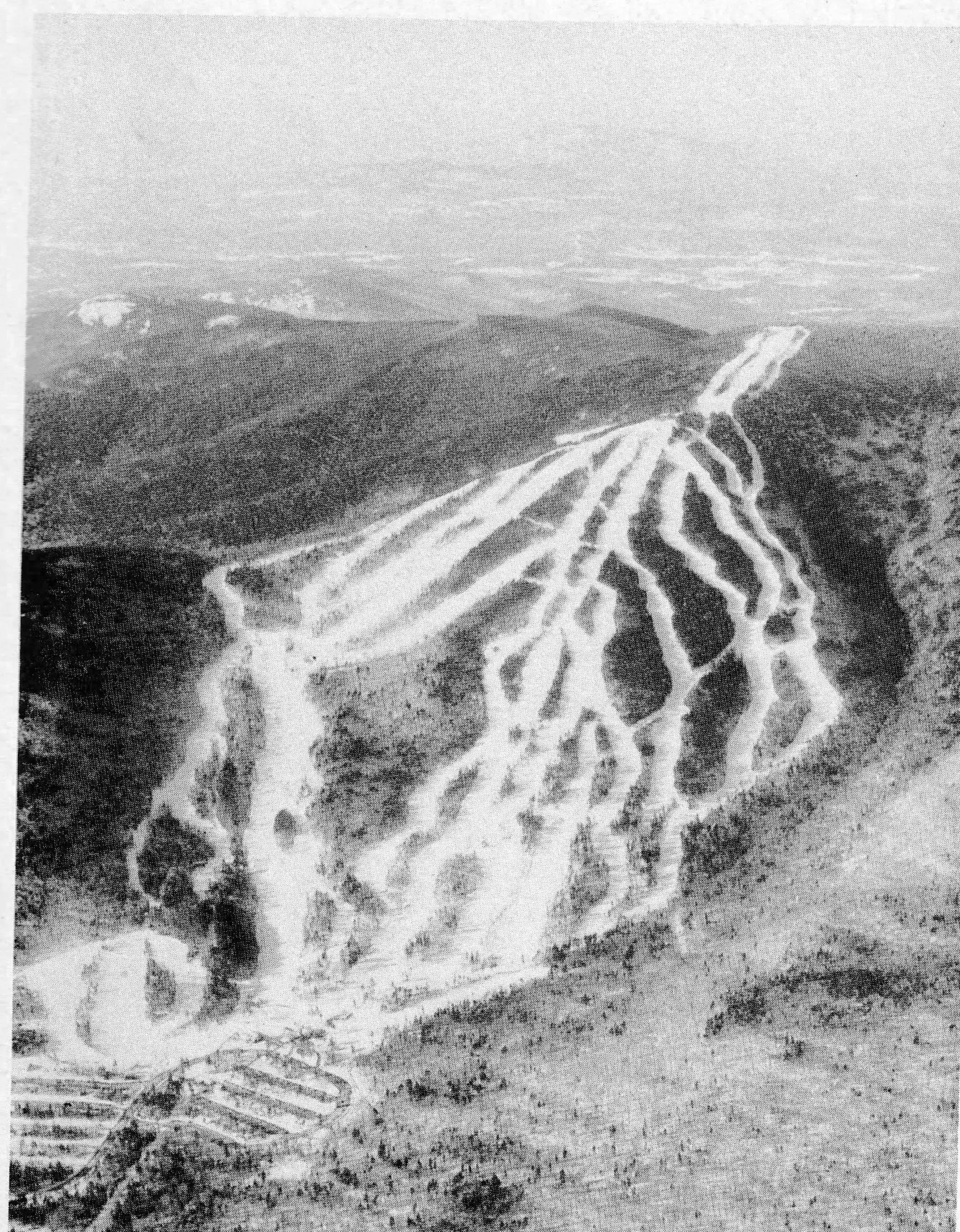
A cursory examination of ski areas in New Hampsire indicates that ski trails occupy 20 to 40 per cent of previously forested area (fig. 2). Thus the strip-cutting experiment, which involved cutting 33 per cent of the forest, is a good approximation of how the average conversion to ski trails would affect streamflow.
An important difference from a timber harvest is that construction of ski trails usually involves much more soil disturbance. Excavation is necessary to smooth the trails and to remove or bury boulders and stumps. During the excavation stages, available storage for soil moisture and the usually high infiltration capacity of forest soils are temporarily reduced. The potential for increases in runoff, erosion, and sedimentation is greater than after a forest harvest. Extra precautions — such as the installation of water bars, cross drains, and culverts — are necessary to provide for the added runoff.
Erosion and sedimentation can be even more serious problems when the excavation is close to existing streams. Where it is necessary for trails to cross streams, properly located culverts or bridging systems are essential for minimizing erosion. When a trail parallels a permanent stream, an undisturbed zone of trees left between trail and stream will trap sediment that washes off trails during construction and will also protect streams against temperature changes.
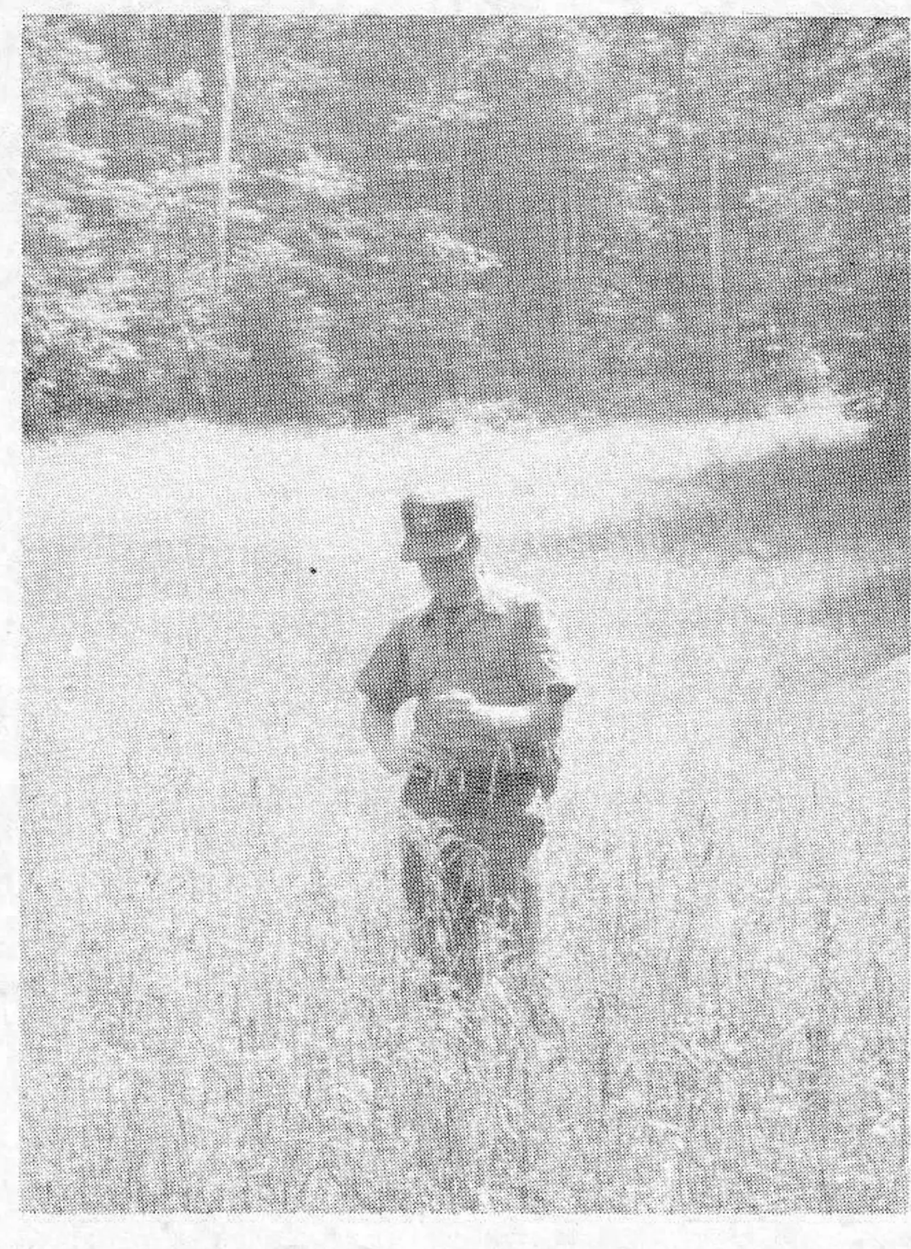
Changing the location of a stream channel is an especially hazardous operation that could greatly increase sedimentation. Stabilization of new channels in steep terrain is especially difficult because of high stream velocities and easily eroded soils. Obviously excavation in or near stream channels should be avoided. When it cannot be avoided, care and ingenuity must be used to quickly stabilize the new channel. More detailed information about controlling erosion and sedimentation is given in references listed at the end of this article.
The Hubbard Brook studies have shown that streamflow returns quickly to before-cutting levels as regrowth of trees takes place. Similarly, revegetation of new ski trails with grasses and herbaceous plants will help both quantity and quality of streamflow return to before-cutting levels. Experiments at other locations in the eastern United States have shown that watersheds converted from forest to healthy grass have water yields similar to those of the original forest. However, the grass cover must be kept vigorous, which means periodic additions of fertilizer. Many ski areas now have trail-maintenance programs adequate for this purpose. Fertilizers must be used carefully to insure that the added nutrients are not washed or leached into streams.
Snowmaking and grooming should not greatly affect streamflow. Usually snowmaking is limited to a small portion of the total ski area in ski slopes and thus to an even smaller portion of an entire watershed. Also, the amounts of machine-made snow seldom exceed the equivalent of five to eight inches of precipitation per season. Such additions are quickly masked when compared with precipitation for the entire watershed. Grooming may change the physical characteristics of snow and affect the melting rate, but we know little about this. A possibility is that roughening of the snow caused by grooming equipment and skiers may increase absorption of solar energy and thus speed melting.
Applying Forest Findings To Ski Areas
Consider a hypothetical conversion of forests to ski trails. Assume that 30 per cent of a forested watershed in New England is converted to ski trails and that excavation is carefully executed; stream channels are not unreasonably disturbed; buffer zones of trees are left along the channel; revegetation and fertilization are started immediately after the conversion; and snowmaking is at typical amounts. What will happen to streamflow?
Judging by the Hubbard Brook research, we would predict that total summer streamflow can be expected to increase by one to two inches. The increase will be greatest immediately after clearing the trails and will gradually disappear in three to four years as a healthy new cover of grasses and herbaceous plants becomes established. There will be some sedimentation and leaching of chemical ions to streams during this same period; but if construction is done properly, common sense practices can keep these problems, especially sedimentation, at a minimum. Stream temperatures should remain pretty much unchanged as a result of the protective buffer strips. At the end of the winter season, snowmelt may occur earlier on the ski trails, and snowmelt runoff may begin several days earlier than in undisturbed forests.
The changes in streamflow listed above are not cause for major concern. Most increases in quantity of flow will occur during periods when streamflow is at low levels, so stream channel capacity will already be adequate. We cannot overemphasize the importance of keeping soil and stream channel disturbances to a minimum and quickly establishing a new vegetative cover. Otherwise, sedimentation will be the most important problem.
Our own measurements at several ski areas in New England show that, where sedimentation occurs from ski areas, aquatic insect populations, which serve as indicators of severity of sedimentation, can be reduced by up to 50 per cent. Sedimentation sufficient to adversely affect aquatic insects violates most state water-quality standards. In most cases, we noted that the increased sedimentation was caused by shortcut methods during construction or maintenance phases rather than by inadequate planning.
From the limited amount of data available, it does not seem that increased leaching of chemical ions into streams will be a serious problem. Changes in stream water ions were detectable, but not great, after the strip-cutting at Hubbard Brook. Also we measured changes in chemistry on three New England watersheds where streams were directly influenced by established ski trails. In some cases, calcium levels increased from 2 ppm to 5 ppm, iron from 0.2 ppm to 0.6 ppm, and nitrate from 1.7 ppm to 3.0 ppm. Surveys conducted in these streams showed that these changes were not large enough to affect populations of fish and aquatic insects.
James Hornbeck is principal forest hydrologist at the Northeastern Forest Experiment Station’s Forestry Sciences Laboratory at Durham, N.H. Gordon Stuart is watershed specialist on the staff of the supervisor, White Mountain National Forest in Laconia, N.H.