

The Northeastern states appeared to be on their way to a severe winter in the fall of 1972. October averaged four to eight degrees below normal with many weather stations experiencing the earliest freeze in more than 30 years, and snow fell at many areas from southern Pennsylvania northeastward into New England.
November maintained the cold and there were record rains and/or snows. There were four vigorous storms accompanied by winds as high as 50 to 70 miles an hour, heavy rains and strong winds. Although temperatures averaged two to five degrees below normal for the month, only a few extreme early season temperature records were set. One of the most noteworthy statistics about November was the rainfall—amounts were two to three times normal.
In December, temperatures returned to normal and in some cases averaged above normal. However, the excessively wet and stormy conditions persisted, and the year ended with many cities reporting the wettest December and year on record. The high frequency of cloudiness in December also established new records. Most places received only 10 to 20 per cent of possible sunshine and Rochester, N. Y., had only three per cent of the possible sunshine, which is the equivalent of only one full day of sunshine for the entire month.
Snowstorms in December were generally confined to the extreme northern states, but some stations in Maine reported new all-time December snowfall totals. Ice storms were unusually frequent and widespread. The glazing of December 30 and 31 was unusually severe across New England, depositing up to one inch of ice on some surfaces.
The weather made a dramatic change to start the New Year in 1973. Skies cleared and temperatures soared to 15 degrees above normal. January went on to be abnormally pleasant, although there were spells of quite cold weather. Cloudiness contrasted greatly with December and most sections reported 55 per cent to 65 per cent of possible sunshine. Temperatures for the month averaged one to three degrees above normal, but except for cold spells, the month was exceptionally mild. Snowfall was well below normal everywhere, and many localities still had not seen measurable snowfall for the season.
February featured dramatic temperature swings with alternating periods of warm and cold. Temperatures for the month averaged near normal; however, snowfall was again very scant and many New England areas which had received record early season snows lost their snow cover during the mild spells.
The month of March quickly devastated any hopes that snow lovers still had for a winter comeback. The first 17 days of March averaged 10 to 20 degrees above normal, making it feel more like late April. Navigation resumed on Lakes Erie and Champlain in mid-March, well ahead of schedule and snowfall was virtually non-existent throughout the Northeast until the last week of the month when a few snowstorms hit the ski areas of New England.

In summary, the 1972-73 winter will go down in history as one of the mildest and least snowy on record.
Where Did The Snow Go?
- Overall, snowfall was well below long-term averages — most population centers along the East Coast had less than 10 per cent of normal snowfall.
- Temperatures averaged above normal; in some areas, higher than it has been in 30 years. This meant that when snow fell, it didn’t last.
- By contrast, parts of the Carolinas, Georgia and Alabama had far more snow than usual, and in some western states there were all-time record snows.
How Can This Snowfall Pattern Be Explained?
- When it was cold in the Northeast, storms followed a path farther south than usual. This may have been a result of unusually cold ocean temperatures east of the Carolinas, and exceptionally warm waters off the middle Atlantic and New England coasts. Water temperatures off the East Coast reached record levels; in some cases 15 degrees above normal.
- The unusual persistence of the warm weather in the Northeast meant that storms that did come were more likely to bring rain.
- Even when the air was initially cold enough for snow, easterly winds ahead of storm systems brought warm air in off the unusually warm ocean and quickly changed the snow to sleet, freezing rain and finally to rain.
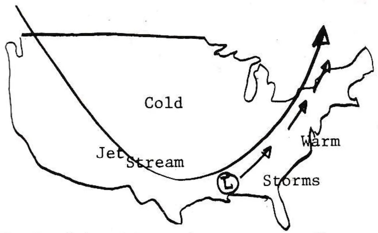
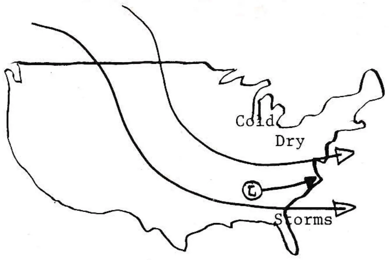
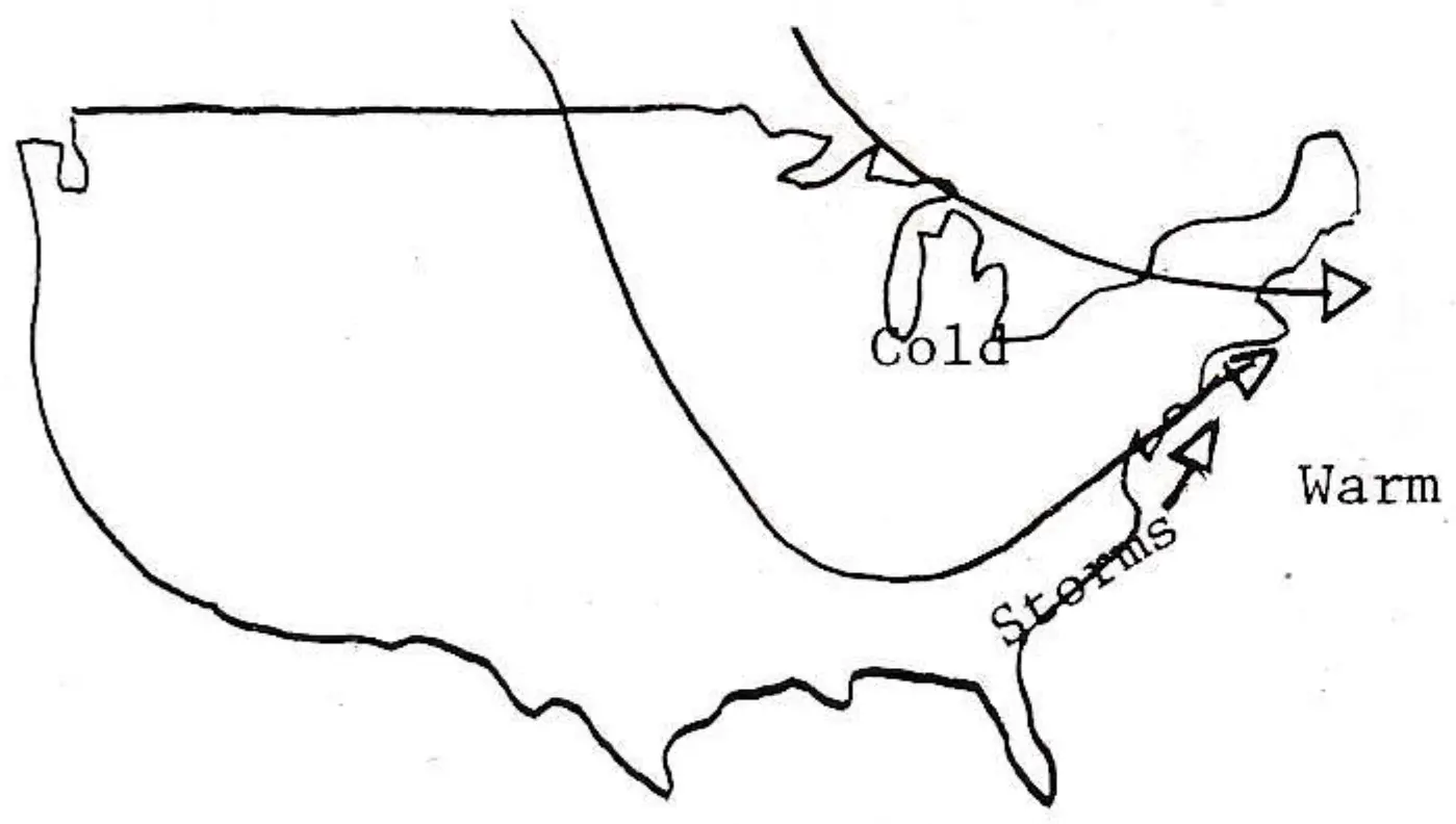
- Some meteorologists attribute the unusually warm winter to the position of the jet stream, but this is a simplistic view because the jet is only part of the overall upper air pattern. The jet is simply a zone of very fast moving air, passing through the troughs and ridges of upper air winds. To the north of the jet it is usually cold and to the South it is warm.
The upper air winds that affect our weather show up as a broad current encircling the globe. There are a series of four to six waves in this pattern. The position of these waves determine whether it will be warm or cold, wet or dry at a given locality. Once the waves are distributed around the hemisphere in a certain way, they often tend to remain fixed for two to three weeks or longer.
This past winter two basic air patterns prevailed with unusual persistence and both suppressed snowfall. The dominant pattern was one favoring warm, wet weather. It consisted of a trough in the middle of the country and a ridge along the East Coast. The second most frequent pattern was cold and dry. It was characterized by a trough off the coast and strong northwest winds over the eastern states. Thus, it was cold and there were no storms to bring snow. The net effect of these two patterns resulted in long periods of unusually warm, wet weather separated by relatively short seven to ten day intervals of cold, very dry weather.
What About Next Year?
There is no proven method of making reliable forecasts for a time so far in advance. However, centuries-long records show that mild winters like this have occurred in the past, but in most cases the weather returned to normal or even reversed itself within one to three years.
Perhaps area operators will be able to take comfort in the predictions of a Czech meteorologist that the past mild winters will soon be followed by cold, harsh ones. He notes that Central European fruit trees flowered in December 1185, cherries ripened in March of 1241, and that roses bloomed at Christmas in 1778. But each of these unusually warm winters was followed quickly by cold, snowy ones.