



SAM Magazine—Perisher Valley, Australia, July 14, 2026—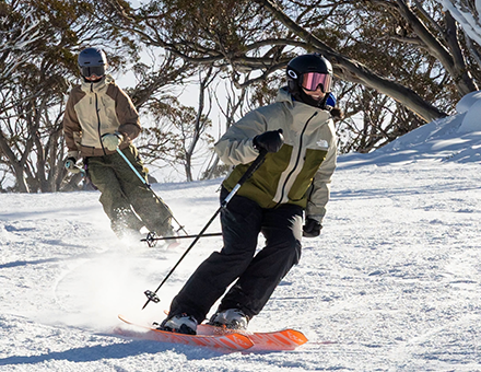 Perisher, AustraliaAfter an uneven start marked by limited natural snowfall across Australia and New Zealand, the Southern Hemisphere ski season is beginning to gain momentum. Resorts have steadily expanded operations in recent weeks thanks to snowmaking and a handful of July storms, while forecasters are now tracking what could become the most significant snowfall event of the early season across the central Chilean Andes.
Australia's season opened over the King's Birthday holiday weekend, June 19-20, but persistently warm and dry weather limited terrain throughout much of the past month. Several resorts have relied heavily on snowmaking while gradually expanding operations. Resort operators expressed optimism that a series of July storms would allow additional terrain to open ahead of the busiest holiday period, according to reporting by The Australian.
At Perisher, Australia's largest ski area, only a fraction of the resort's lifts and terrain were operating in early July, although a recent storm dropped 28 cm (11 inches) on the ski area over the last few days. Neighboring Thredbo also reported limited trail availability, with 25 cm (10 inches) of fresh snow in the last 72 hours allowing it to bring some additional lifts online.
Across the Tasman Sea, New Zealand has fared somewhat better in recent days, with several South Island resorts receiving up to 80 cm (32 inches) of fresh snow, marking a significant improvement after delayed June openings.
At Coronet Peak near Queenstown, operators reported 7 of 8 lifts spinning and roughly 80 percent of terrain open following the storm cycle, while nearby The Remarkables had 6 of 7 lifts running and about 70 percent of terrain available. Farther north at Mt. Hutt, one of the country’s largest ski areas, five lifts were serving 22 of 23 groomed trails; despite 97 cm (38 in) of snow in the last seven days, off piste conditions remained firm.
In South America, a powerful Pacific storm is forecast to arrive later this week. Forecast models indicate central Chile could receive more than a meter (3 feet) of snowfall over several days, with the heaviest accumulations expected at resorts including Valle Nevado, La Parva, Portillo, and El Colorado. Current forecasts project approximately 120 cm (47 inches) of snowfall at Valle Nevado during the next seven days, while some models show substantially higher localized totals around La Parva.
If the storm delivers as forecast, it would dramatically improve snowpack across Chile's central Andes, allowing resorts to expand terrain and strengthen base depths heading into the second half of July. The same system is also expected to benefit portions of neighboring Argentina, where resorts including Cerro Catedral near Bariloche, Las Leñas in Mendoza, and Chapelco in San Martín de los Andes have likewise been building terrain gradually through the opening weeks of the season.
The storm could mark a turning point for a season that has thus far depended more on snowmaking than natural snowfall across much of the Southern Hemisphere. With the busiest weeks of the winter season still ahead, operators throughout Australia, New Zealand, Chile, and Argentina will be watching closely to see whether fresh storms deliver on their promise, even as the Northern Hemisphere contends with record-breaking summer heat.